Come explore what lives in Narrow River!
Photos by John McNamara
Thanks to all who joined us Saturday, June 6, 2026 to explore What Lives in the River!
Our Fall 2026 What Lives in the River will be held on Saturday, September 19 from 9-11am. Registration link coming soon!
This popular family science and exploration event is held annually on a Saturday morning in June and a Saturday morning in September at 95 Middlebridge Road, Narragansett.
About What Lives in the River:
All ages are invited to join Narrow River Preservation Association for this hands-on exploration of fish, shellfish, crabs and other inhabitants of Narrow (Pettaquamscutt) River. We will use nets large and small to catch river creatures and examine them in touch tanks and under microscopes. Experts and guide books will be on hand.
Come explore what lives in Narrow River! Photos by John McNamara
FREE and open to the public- FUN for all ages! Children under 12 must be accompanied by an adult. All young children and youth should be supervised closely at all times.
Participants are welcome to get into the water, please dress appropriately. Because this is a natural environment, there are sharp objects in the water. Boots, sandals or shoes that can get wet are recommended. The gathering area is a field with grass and dirt surfaces. Wheelchairs are welcome.
Please come to the event even if you didn’t preregister! Walk-ins are also welcome.
Our Fall 2026 What Lives in the River will be held on Saturday, September 19 from 9-11am.
Clinging jellies have been found in Narrow River. Click here to learn more about clinging jellyfish.
Annually in late June, Narrow River Preservation Association hosts a one mile open water swim in one of Rhode Island’s most scenic waterways.
PARKING: Swimmers and spectators are asked to park at 1240 Boston Neck Road, Narragansett and take shuttle to the swim. Swimmers not wishing to take the shuttle may be dropped off at the course, but there is NO PARKING at or near the course.
2026 Details:
When: Saturday, June 20, 2026, 9:00am (rain or shine)
Where: Swim Start: URI Boathouse – Flagg Rowing Center, 166 Walmsley Lane, North Kingstown, R.I.
Parking for Shuttle: The Church of Jesus Christ of Latter-day Saints, 1240 Boston Neck Rd., Narragansett RI 02882. **For the safety of ALL participants, parking will be provided at the The Church of Jesus Christ of Latter-day Saints, 1240 Boston Neck Rd., Narragansett RI 02882. Parking is free. Two school buses will be making continuous trips to the Boating Center starting at 7:15 am. They will also return swimmers to their cars after the swim. NO PARKING will be allowed near the swim start – no parking on Walmsley Lane nor River Road nor at the Boat House.
Swimmers not wishing to take the shuttle may be dropped off at the course, but there is NO PARKING at or near the course.
Registration: Online only. Online registration closes at 11PM FRIDAY JUNE 19th. No day of registrations allowed.
Entry Fee: $45 if registered before June 1, $55 after June 1. Includes 2026 Turnaround Swim T-shirt. Entry fees are non-refundable.
Registration and checkin (green star): URI Boathouse Start, Course, and Finish (black dashed lines): In water start at beach adjacent to the URI Boathouse dock. Swim with orange buoys on your left, round the farthest buoy counterclockwise, swim back with buoys on your left. Finish by crossing the timing mat on shore.
Swim Sponsor:Swim Sponsor: Includes swim registration ($45) one year NRPA membership ($25) and name listed on the 2026 Turnaround Swim publicity ($30). Minimum $95. Any amount above this is welcome. Go to the DONATE section of the website after you register for the race if you wish to ADD your sponsorship.
Distance: One Mile (1/2 mile out and 1/2 mile back). Common start for wetsuit and non-wetsuit divisions.
Check In: 7:30 a.m. to 8:40 a.m. No one will be admitted to the Turnaround Swim unless they checked in, signed their waiver, and received a numbered swim cap no later than 8:40 a.m.
Maximum Time: Swimmers are given one hour to complete the swim.
Mandatory Safety Briefing: 8:55 a.m.
Safety: Because of the uncertainty of weather conditions such as fog or lightning, the lifeguards and event committee reserve the right to cancel the event to ensure the safety of the participants.
A WORD OF CAUTION! The Narrow River is home to Rhode island’s only substantial population of native oysters, but the edges of these wonderful oysters can be SHARP! We recommend protective footwear for the Turnaround Swim. Participation is at your own risk.
Curious about swimming in Narrow River? Check out this essay by swimmer and Narrow River enthusiast Veronica Berounsky!
On Saturday morning, August 8, 2026, Narrow River Preservation Association welcomes artists of all ages and skill levels joined us to create art along Narrow River.
“Plein air” (open air) painters will demonstrate their techniques and others will give instruction in drawing and painting scenes of the Middlebridge area.
Bring your own easel or sketch pad. Sketch your version of an expansive landscape view or crouch down and capture a still life view of oysters on the fringe of the salt marsh.
NRPA will provide other guided activities including paper and supplies needed to make seaweed art and fish prints. We encourage you to bring blank T-shirts and/or pillowcases so you can make a fish print onto those, too!
FREE and open to all ages! The gathering area is a field with grass and dirt surfaces. Wheelchairs are welcome.
If you would like to volunteer to support this event, then please VISIT THIS LINK to share your areas of interest with us.
Click here to read an article in The Independent about Art on the River 2023 featuring photos by Michael Derr.
Thanks to everyone who joined us on Saturday, August 6, 2022 for Art on the River
We had a wonderful time creating seaweed art, making fish prints, learning to play hubbub from Silvermoon LaRose of the Tomaquag Museum and then each decorating our own hubbub game to keep!
Hannah (left) and Silvermoon look on as Veronica shows them how to make seaweed prints.Silvermoon (right) taught guests how to play hubbub, an Indigenous bowl game, then invited each attendee to decorate their own game pieces to keep. Plein air painting along the riverFish printsMaking art with seaweedSeaweed ArtFish printsExperienced artist and NRPA Board President Richard Grant shows others how to draw perspective.
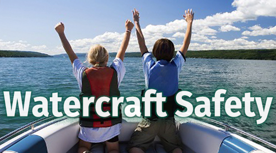
Navigating the Narrow: A Guide to Boating on the Narrow River
Photo courtesy of Russ Godin.
Many residents and visitors to the Narrow River enjoy kayaking, canoeing, paddle boarding and boating. These are some of the best ways to enjoy the watershed. Narrow River Preservation Association (NRPA) works to preserve, protect, and restore the natural environment and quality of life for all communities within the Narrow River (Pettaquamscutt Estuary) and Watershed. This includes those who utilize the watershed in boats and personal and paddle watercraft.
Thanks to those who joined us for Navigating the Narrow Watercraft Safety Event in April 2025.
Navigating the Narrow provides information to boaters, kayakers, paddle boarders and all who simply love the Narrow River about safely and responsibly enjoying this amazing natural resource.
We provide informational displays and a panel of local experts to lead a discussion about safe boating and ways that boaters can protect the delicate local ecology. We hope you will join us at a future event.
Navigating the Narrows Video by Parker McGregor
This video addresses basic boating safety for the Narrow (Pettaquamscutt) River. Many thanks to Parker McGregor for making this informative video for his senior project.
NRPA Supports and Encourages Safe and Responsible Boating on the Narrow River!
The Narrow River is a beautifully unique waterway tidal estuary that flows from its headwaters in North Kingstown to the Atlantic Ocean. Despite the serene and calm environment, the dynamic nature of the waterway presents many risks to boaters. Wind direction, travel direction, and tide height need to be considered every time you go out on the water.
Navigating the Narrow River is under the jurisdiction of the United States Coast Guard (USCG), Rhode Island Department of Environmental Management (DEM), and three local municipalities of Narragansett, North Kingstown, and South Kingstown. Each municipality has their own harbor master who is responsible for rule enforcement. Safe and responsible boating requires the proper attention and education of boaters.
Navigating the Narrow: Safe & Responsible Boating
Be Prepared — Plan for your trip!
Plan: Create a Float Plan (an overview of a boat excursion that can give authorities a head start in looking for a boater if he or she fails to reach his or her destination) and stick to it.
Boat: Perform a Safety Check and verify the boat is in good working order.
Weather: Watch for inclement weather and be aware of changing conditions.
Passengers: Verify your passengers know the proper safety procedures in the event of an emergency.
Life jackets are essential!
Always wear a life jacket and make sure it fits properly.
BY LAW kayaks, canoes and paddle boards require life jackets.
Children under 13 must always wear a life jacket on motorboats.
Know the River. Make sure you know where you are going and how you are getting there. The Narrow River changes season to season and with significant weather events.
Tides: High tide or low tide, time your trip accordingly. Be aware of low tide obstructions such as sandbars. Click this link for the Narrow River Tide Chart.
Know where the No Wake Zones are and obey speed restrictions.
When traveling under a bridge, check the direction of the current and adjust your speed so you can control your boat in the tight area.
When beaching your boat, always go against the current so you have steerage at low speed and always have a stern anchor to keep the boat aligned.
Follow the Boating Rules:
Be courteous to others on the water (people, waterfowl, and animals).
Power driven vessels ALWAYS give way to non-powered vessels (sail boats and human powered watercraft)
Don’t overload the boat with people or equipment.
Treat your fueling operations with care.
Practice proper boat propeller safety.
Check for harmful fumes.
Follow proper anchoring procedures (do not anchor in protected areas or in the navigable channel).
Follow proper docking procedures.
Follow proper lighting for night navigation.
Know your boat’s maximum passenger capacity.
Ensure your boat is properly maintained and serviced.
DO NOT DRINK AND BOAT. In Rhode Island, it’s illegal to operate or drive any watercraft while under the influences of drugs or alcohol.
RIDEM (Rhode Island Department of Environmental Management) and USCG (United Stated Coast Guard) websites have many resources to reference.
Exercise good judgment and use common sense on the water.
No Wake Zone Map for Lower Narrow River. Source: 2016 Narragansett Harbor Plan. Click the map for a larger version.
Frequent Asked Questions
Who should I call if I witness a boating accident or other emergency on the river?
Call 911 for all life safety and significant emergencies. An RIDEM Rhode Island Boating Accident Report must be filled out by the owner/operator of any vessel that is involved in a boating accident–on the inland waters and the coastal waters contiguous to this state–that meets the following criteria:
Loss of life or disappearance from a vessel.
Injury to any person that requires medical treatment beyond ordinary first aid. If you go to the emergency room or call a rescue, it is beyond first aid.
Property damage in excess of $2,000 (combined damage to both vessels, if more than one vessel is involved.)
Complete loss of a vessel.
If more than one vessel is involved the owner/operator of all vessels must fill out and file a boating accident report.
Reportable accidents must be submitted within five (5) days after the incident on forms provided by the department. Accidents must be reported to the state authorities where the accident occurred.
What should I do if I witness a boater breaking the law?
People who spot boaters making a wake or otherwise breaking the law are encouraged to call the Municipal Harbormaster. If a boater is doing something particularly egregious, you are encouraged to photograph the boat (including identification numbers) and email the photo and a description of the offense to the Harbormaster:
What do I need to be aware of regarding preservation of the river?
NRPA has many ongoing water quality and watershed preservation programs. Boaters should be respectful of the natural habitats therein and do their best not to disturb them.
Photo courtesy of Margaret McGregor.
Studies on water quality and clarity found that boats did have a noticeable impact. The presence of vessels seemed to increase the growth of algae and kick up sediments, both of which obstruct sunlight and spoil the water.
Additionally, deposits left from boats can change the water’s chemistry and a decrease in water quality is bad for both wildlife and humans. A large amount of impairment to wildlife is also caused by smaller, less noticeable aspects of boats. Chemicals used to clean, protect, and run watercraft often leach into the water, severely impacting the environment and weakening or killing the wildlife. Aquatic plants and animals have specific requirements for light, temperature, pH level, etc. Toxins from detergents, paints, petroleum products, batteries, and metals have disastrous effects on wildlife’s ability to survive and thrive, including cancer, mutations, birth defects, and outright death.
NRPA suggests measures such as the following to help mitigate any negative impacts people or watercraft may have on the river and its inhabitants:
Observe No Wake Zones: proper speed control in No Wake Zones will help preserve the habitat in these areas by reducing the amount of erosion of the shoreline.
Maintain boat engines so they do not leak fuel into the river.
Safely dispense of fuel and oil to prevent any leakage into the river.
Use environmentally-friendly cleaners and rinse thoroughly away from the river, if possible.
What should I be aware of regarding the river’s flow, tides and dynamics?
The Narrow River is in constant motion. The daily tides affect the river’s flow, shoreline and salinity levels. They are influenced by lunar and seasonal fluctuations and weather events.
The Narrow River is not a navigable waterway. Its boating channels are not professionally maintained. Depths at low tide can be as low as one foot in the boating lanes, with sandbars surfacing above the water level.
Clearance under the Middle and Lacey/Bridgetown Bridges varies with the tides and weather conditions. The clearance can be as low as four feet.
High and low tides are caused by the moon. The moon’s gravitational pull generates something called the tidal force. The tidal force causes Earth—and its water—to bulge out on the side closest to the moon and the side farthest from the moon. These bulges of water are high tides.
Two high tides and two low tides happen every 24 hours and 50 minutes. Their time varies throughout the year. Click this link for the Narrow River Tide Chart.
The flow at the mouth of the river allows the ocean water to come into the river. The Narrow River has salinity well into the upper reaches above Lacey Bridge (Bridgetown Road). At dead low tide it looks like the river is blocked off from the ocean. The river has been blocked by sand at its mouth during extreme weather conditions. These events are temporary, and Mother Nature finds way to return the river to its normal conditions.
What are the boating certification requirements?
The following are Boating Certification Requirements:
All boat operators born after January 1, 1986.
All operators of personal watercraft (jet ski), regardless of age and regardless of residency
Out-of-State Residents operating a vessel (other than a Personal Watercraft-see above), must meet the requirements of their home state in order to operate in Rhode Island Waters. For questions, contact DEM/Environmental Police at (401) 222-3070.
What are the boating rules and are they different for different parts of the Narrow River?
The Narrow River is under the jurisdiction of the United States Coast Guard (USCG), Rhode Island Department of Environmental Management (DEM), and three local municipalities (Narragansett, North Kingstown, and South Kingstown). Each municipality has their own harbor master. RIDEM and the USCG websites have many resources to reference.
The rules for boating are not different in different parts of the river, but each area has its own topography. Safe and responsible boating requires proper attention by boaters in all areas. The lakes are open deep areas with some shallow areas, the narrows are tight areas and mostly No Wake Zones, the beach area is more affected by the tide and has more varying sand bars, and the mouth of the river is difficult to navigate.
How can boaters and kayakers best interact?
Motorboats must to yield to paddle craft and maintain control of their boat at all times. Just because there is a local channel that boaters use due to the water depths, motorboats must still operate with due care around paddle craft regardless of where they are.
Paddle craft should be courteous by staying clear of the areas that are better suited to power boats whenever possible. Paddle craft should be respectful of motor boat channels, watch for moving boats, and minimize their time in the motor boating lanes. These channels are narrow and fast moving and motor boats do not have much room to maneuver within them, especially during low tide.
Click the map for a larger sized map.
What are No Wake Zones and where are they?
“No Wake” means operating a boat at the slowest speed necessary to maintain steerage and that reduces or eliminates waves that appear as white water behind the boat.
Current laws stipulate no wake under bridges, around mooring fields, near docks and near swimming areas, and, although the inlet to the river is not marked as a No Wake Zone, is a safe practice to observe there. While the motor boating channel cannot be better marked at this time, the speed limit must meet the above definition.
South Kingstown Ordinance 4-5.4 states the following for No Wake Zones on the Narrow River: “No vessel shall be operated in excess of five (5) miles per hour and/or create a wake within the area from Hahn Avenue to four hundred (400) feet north of Radial Drive, in the Narrow River.” If you witness someone making a wake in a No Wake Zone, contact the Municipal Harbormaster.
As for the speed limit outside of No Wake Zones, boaters need to be safe and responsible. R.I.G.L 46-22-9.5 Speeding regulates speed on RI waters as follows, unless local regulations are more restrictive: “(a) No person shall operate any motor-boat or vessel in any harbor or inlet or any pond or other confined body of water in this state in excess of forty-five (45) miles per hour during the hours from sunrise to sunset and twenty-five (25) miles per hour during periods of darkness or other periods of restricted visibility; provided, however, nothing herein shall prohibit the posting of lesser speed limits where deemed necessary by the appropriate state or local authority.”
Access to the River-There is no limit of the number of boats or paddle craft allowed on the river. Boaters and paddlers should always take care when navigating the river, especially when it is being heavily used.
Recreation users riding the tide such as large inflatables (inflatable ducks, swans, alligators, frogs, creating a human chain, without steerage/paddle power) should use extreme caution and must also follow safe navigation practices and be courteous of the boaters and paddle craft.
What are best practices for fueling a boat?
When fueling a boat, you should observe the same rules as when fueling a vehicle combined with a few additional precautions specific to the water:
No matter where you are refueling, always clear the area of anyone not directly involved with fueling the boat.
Put out all smoking materials and secure your boat to the dock.
Turn off engine(s) and electronics, and extinguish all open flames.
Fueling your boat with a portable container can take time, make sure your container is comfortable to carry, hold and balance.
Portable containers and Jerry Jugs can be spill prone so go slowly, pour deliberately and watch you container (especially the nozzle mechanism) for signs of wear.
Keep the nozzle in contact with the edge of the fill to prevent build-up of static electricity and sparking.
Don’t top off your tank. Know how much fuel your tank holds and fill it to about 90%. Fuel expands as the temperatures rises.
Clean up fuel spills immediately with an oil-only absorbent pad. Wipe down the bilge or any interior parts that may have come in contact with fuel.
Treat your fueling operations with care. Never use hands-free clips and avoid any distractions while fueling.
On the dock, put an absorbent pad under the container.
Consider using a funnel. A filtered funnel will help prevent contaminants from entering the fuel tank.
Ensure the nozzle stays in contact with the tank opening.
Always store portable fuel tanks out of direct sunlight and keep in a cool, dry place to minimize condensation.
* For information about the proposed dredging at the mouth of Narrow River, see this page. *
July 2025 – Drone video showing status of the mouth of Narrow River
May 2025 – Drone video showing channel between Sprague Bridge and mouth of the river at low tide
Many thanks to Steve Carey for this fascinating video of the sands at the mouth of the river at low tide in late May 2025. NRPA is sharing this video for informational purposes only. Under no circumstances will NRPA be liable to any person for any indirect, special, incidental, or consequential damages arising from the use of this information.
March 2025 – Drone video current status of the mouth of the river
March 11, 2025 – Removal of the house at the mouth of the River
Steve Carey, retired University of Rhode Island Graduate School of Oceanography professor, has very generously shared this incredible drone video of the mouth of Narrow River.
This video show the before (January 13, 2024) and after (March 11, 2025) of the house that formerly sat at the mouth of Narrow River.
(For best viewing, we recommend adjusting the settings on the videos to 1080 HD resolution.)
This second video by Steve shows the area after the house has been completely demolished.
October 2024
Enjoy this drone video from October 2024 generously shared by Sam Morrissey.
April 8, 2024
Steve Carey, retired University of Rhode Island Graduate School of Oceanography professor, has very generously shared this incredible drone video of the mouth of Narrow River. Filmed April 8, 2024, it shows the new shape of the area.
(For best viewing, we recommend adjusting the settings on the videos to 1080 HD resolution.)
January 2024
On Thursday, January 11, Steve Carey, retired University of Rhode Island Graduate School of Oceanography professor, filmed the mouth of the river. There had been a significant storm the day before. Many thanks to Steve for sharing his videos.
(For best viewing, we recommend adjusting the settings on the videos to 1080 HD resolution.)
Steve shot this footage on Saturday, January 13 at about 1:30 pm, well past the morning high tide. The house at the mouth of the river had suffered even more damage from the previous night’s storm.
The videos below, as well as this photo from February 2021 show the same area.
Mouth of Narrow River February 2021. Photo by Steve Carey.
2022
Similar to what occurred February 1-2, 2021, the sand spit at the mouth of Narrow River was overwashed by waves during a strong Nor’easter on January 17, 2022. Once again, a significant amount of sediment from the beach face was transported into the river. In fact the overwash from this storm essentially plugged the channel which typically carries the majority of the flow during an outgoing tide, forcing water to exit the river along the north side of the large sand bar just inside the mouth (the “flood tide delta”).
The channel and sand spit are perpetually evolving in response to coastal storm events, waves, tides and currents, and sediment moving along Narragansett Town Beach. These are natural coastal processes. The tidal exchanges between the bay and the river continue and the spit may return to a similar (pre-storm) configuration over time, although it is possible that the northern channel could widen and become dominant. Time will tell.
Below are photos of the mouth of the river over time. Many thanks to our contributing photographers!
DON’T dump lawn clippings, leaves or trash into the river.
DO operate watercraft responsibly.
DO keep pet waste away from river and storm drains.
DON’T feed waterfowl.
DON’T put anything down the sink that you wouldn’t eat or drink.
DON’T dump anything down storm drains.
DO report suspected problems to RI Department of Environmental Management (RIDEM) at (401) 222-1360.
Friends of Canonchet Farm has created this great guide to invasive plants in our area. Click the image to view or download the booklet.
This excellent guide provides specific information on ways to be sure your activities are safe and healthy for your nearby waterway! Click the image to download the free guide.
Click the image to download a PDF of this excellent guide!
Narrow River dredging plan as approved by CRMC April 14, 2026. Click here for full report, including additional images.
April 2026 update:
Proposed Dredging Approved
On April 14, 2026 the Coastal Resources Management Council (CRMC) unanimously approved that application for dredging the mouth of Narrow River that was submitted by the Town of Narragansett. This is important work that needs to be done.
A big thank you to NRPA Board members Craig Wood and Jim Vogel who have done much of the NRPA work on this project. Their presentation, Dredging The Mouth of the Narrow River: History, Current Conditions and Future Plans is available to view here.
More background on the subject, including the NRPA position paper, is available on this page (scroll below).
Click here to read the staff report that was presented at the April 14 meeting. This report is what was approved.
NRPA continues to work with the other Narrow River stakeholders to ensure the project is successful and to inform the public on the project’s progress.
Permits for the project are being reviewed by CRMC, RIDEM and Army Corps of Engineers and expected to be received in early 2026.
The Town of Narragansett is planning for the project and reviewing funding options.
If all permits and town approvals occur in 2026 the project can occur in the 2026-2027 construction season.
On July 31, 2025, NRPA submitted a letter to the Coastal Resources Management Council (CRMC) in response to proposed plans to dredge the mouth of Narrow River.
Those who regularly visit the mouth of Narrow River know that the channels and sand spit are constantly reshaped in response to coastal storm events, beach erosion, tides and currents. These are natural coastal processes.
During the past few years, the combination of coastal storms and alongshore sediment transport from the town beach has dramatically increased the volume of sand within the flood tide delta (“sandbar”) just inside the mouth of the river. This has presented a challenge for boaters on the river, particularly following storm events, as the channels near the mouth reorganize and can be difficult to navigate.
It is important, however, to recognize that flood tide deltas (like the sandbar at the mouth) are naturally occurring deposits that form inside tidal inlets and are dynamic landforms that will continue to change as sediment is transported by storm surges, tidal currents and ocean waves.
This time lapse video compares aerial images of the mouth of Narrow (Pettaquamscutt) River from 1951 to November 2025. The red dot in the video indicates the location of the flagpole – a former boat outhaul post placed in the 1960’s by the Dunes Club caretaker.
This flagpole is a former boat outhaul post placed in the 1960’s by the Dunes Club caretaker.
November 2024 Dredging Report Update:
In the last issue of Narrow River Notes, we provided an overview of the options being considered by the Town of Narragansett for dredging the mouth of the river, as well as important considerations to the NRPA Board of Directors and other stakeholders.
In an important development, on October 7th the outgoing Town Council passed a motion to approve Alternative 4 as the selected short term alternate. This alternative involves land-based mechanical dredging with dredged material to be placed in close proximity to the dredge site that is acceptable to regulatory agencies as determined during the permitting process (see graphic below). The motion is fully contingent on the availability of funding (estimated construction cost range $771,040 to $1,252,940).
The motion also directs the Town Manager to seek financing options for the project, continue to coordinate with Foth Engineering on the next steps for obtaining licensing permits, and engage with key stakeholders (including NRPA) to move forward with the project.
As background, a work session was held on August 5, 2024 with the Town Council and the town’s consultant Foth Engineering. Three hydraulic dredging options (Alternatives 1-3) with increasing dredge volumes and the sand being returned to Narragansett Beach, were presented. The cost estimates for the three options were substantial (click here for the full Town Council Work Section Packet for September 16, 2024).
Hydraulic dredging relies on specialized dredging barges and pumps to remove sand and redeposit it elsewhere using hydraulic forces. This dredging method is often far more costly than sand removal via traditional mechanical dredging with long-arm excavators working from land. The Town Council recognized that there is significant community interest on this topic and this initial work session provided an opportunity to continue discussions.
At a second work session held on September 16th, two additional options (Alternatives 4 and 5) involving land-based mechanical dredging were presented. Following the second Work Session, the Town participated in a meeting held by representatives of U.S. Fish and Wildlife Service (FWS). The FWS identified conditions that would complicate the permitting process for Alternative 5, which also included dune restoration along the split. As a result, The Town Council felt the selection of the Alternative 4 will allow the project to advance to the permitting phase now so that construction could proceed in a timely manner pending available financing.
NRPA continues to track the project and provide technical guidance to decision makers on behalf of our membership.
Due to the difficult navigation of the mouth, Tony Columbo of the Mettatuxet Yacht club championed an effort to dredge the sand deposits to the Town of Narragansett. Correspondingly, the Town of Narragansett has hired an engineering firm to develop solutions which aim to restore safe recreational boating while maintaining and preserving critical habitats within the Narrow River. The RI Coastal Resources Management Council (CRMC) Narrow River Special Area Management Plan(SAMP) includes provisions that allow the river mouth to be dredged periodically. The dredged sand would be used to replenish the Narragansett Town Beach. Dredging is only allowed to support safe recreational uses of the river under the SAMP.
NRPA exists to preserve, protect, and restore the natural environment and the quality of life for all communities within the Narrow River; NRPA will be actively engaged in all capital projects proposed in the Narrow River watershed including dredging and dredging alternatives.
NRPA is designated by the RI Rivers Council as the “state-designated Watershed Council” for the Narrow River (Pettaquamscutt Estuary) Watershed. In accordance with General Laws of Rhode Island Section 42-28-8, NRPA has the authority to evaluate proposed actions so that any resulting concerns may be considered by the CRMC.
Issues to be evaluated by NRPA include:
Range of alternatives to meet project objectives
Construction methods (mechanical or hydraulic dredging, access, refueling, dewatering, haul roads, etc.)
Short-term consequences to shorebirds, fish, shellfish and other aquatic resources during dredging activities
Measures taken to avoid and minimize adverse impacts such as Time of Year restrictions to avoid winter flounder spawning or river herring migration
Possible changes to tidal circulation (e.g., improved tidal flushing, changes in current speeds, increased duration and frequency of flooding on upstream salt marshes)
Improvements to boater safety
Effects on other recreational uses
Options for reuse of removed sand beach nourishment dune or salt marsh restoration
Benefits to improved coastal resilience of Narragansett Beach
Physical and chemical compatibility of sediments for beneficial reuse
Initial construction and life cycle costs (anticipated life span/maintenance requirements)
We will update our membership with further information as the project planning advances.
Resources:
NRPA has maintained a library of relevant engineering studies from the last several decades that evaluate the impacts of dredging the river mouth or the beneficial re-use of the dredged sediment. These items are linked below for our membership and members of the public who wish to learn more. We will continue to update these materials as information becomes available.
In a 2009 unpublished draft report, the US Army Corps of Engineers (USACE) Water Management Section discussed results of a numerical modeling study to determine the relative impacts of incremental dredging alternatives at the mouth of Narrow River ranging from 28,000 cubic yards to 68,000 cubic yards. The modeling considered effects on tide range, current speeds, peak volume flows, and tidal prism/flushing time changes. In general, the modeling demonstrated an increased tide range and corresponding reduction in flushing times with greater dredge volumes.
In 2011, the town commissioned the Narragansett Town Beach Replenishment Feasibility. The goal of this study was to identify a potential beach replenishment solution for Narragansett Beach that provides protection for the upland infrastructure and creates a sustainable beach with a reasonable performance lifetime. The beach nourishment alternatives ranged from 50,000 cubic yards (a volume that could be sourced from the mouth of the River, based on the 2009 USACE study above) to 327,200 cubic yards.
In 2016, the US Fish and Wildlife Service (USFWS), USACE, and CRMC recommended that a numerical modeling study be undertaken to determine what the impact of dredging at the mouth might be on the circulation, flushing, and general water quality in the river. A hydrodynamic model was used to evaluate a series of four hypothetical dredging scenarios, from -1 m Mean Sea Level (MSL) to -3 m MSL, which removed between 1.5 m (4.9 ft) and 3.5 m (11.5 ft) from the flood tidal delta at the mouth, or between 21,500 m3 (28,100 yds3) and 184,000 m3 (241,000 yds3). Like the 2009 study, this modeling effort found an increase in the tide range (reduced restriction to the flow) with increasing dredging depth. An example of the model results is presented below, which shows the model-predicted water levels upstream of Sprague Bridge (Boston Neck Road) over a 5-day period. The increase in the tide range was greater for the larger volume dredging scenarios and most noticeable at low tide. The tidal flushing time within the River was reduced from 3.8 days compared to the range of 3.5 to 2.3 days for the dredging scenarios.
Another important consideration with dredging at the mouth and thus increasing the tide range is the effect on Mean High Water (MWH) levels in the area of the USFWS salt marsh restoration project. This restoration project included both drainage improvements and the placement of thin layers of dredged material on marsh surfaces in the river to build resiliency against increasing levels of sea level rise. In response, Craig Swanson and Malcolm Spaulding (the authors of the 2016 model predictions) provided a comparisonof the duration of tidal inundation for the different dredge alternatives with respect to measured marsh control point elevations provided by the USFWS.
Since 1970, Narrow River Preservation Association (NRPA) has been working to engage people to preserve and protect the Narrow River (Pettaquamscutt Estuary) and its watershed.
We need YOUR SUPPORT for our many education and preservation programs, including:
osprey education program for fourth graders, teaching about osprey and concepts of ecology, stewardship and preservation
River Watch water quality monitoring program, testing 13 sites in the river, most since 1991
Lesa Meng College scholarships for local high school seniors pursuing a college degree in science
Science and Art Fair Awards encouraging local students to examine and understand the environment through science and art
What Lives in the River family science exploration event
Art on the River, appreciating the Narrow River through a variety of art forms, including traditional Indigenous crafts
public education through our newsletter Narrow River Notes, online resources and On Pettaquamscutt Annual Speaker Series
watchful eyes on proposed activity and development in the watershed
alerts and communications to the public when issues arise concerning the watershed
and so much more.
We need your support now more than ever. Please donate.
ABOUT US:
Narrow River Preservation Association is a 501 (c) 3 certified non-profit organization based in Saunderstown, RI. NRPA was founded in 1970.
Dr. Veronica Berounsky (left) and Annette DeSilva were honored with 2021 Lifetime Achievement Awards from the Environmental Protection Agency Region 1, for their 30 years of commitment toward protecting, preserving, and restoring the Pettaquamscutt Estuary (Narrow River).
Local Volunteers Receive Prestigious 2021 EPA Environmental Merit Lifetime Achievement Awards for their work on Narrow (Pettaquamscutt) River
Narrow River Preservation Association (NRPA) is proud to announce that long time volunteer Board members Dr. Veronica Berounsky and Annette DeSilva have received Lifetime Achievement Awards from the Environmental Protection Agency, Region 1. NRPA nominated these dedicated people in recognition of their 30 year commitment to the ecology and health of Narrow River and its watershed. We are thrilled that their extensive contributions to our environment have been publicly honored.
A video of the 2021 EPA Region 1 Awards can be seen here.
The program for the 2021 EPA Region 1 Awards can be found here.
ANNETTE DESILVA of Narragansett, Rhode Island
Annette DeSilva is being recognized for her 30 years of outstanding and sustained stewardship of the Pettaquamscutt Estuary, known locally as the Narrow River. In 1992, Annette, with Veronica Berounsky and others, founded Narrow River Preservation Association’s River Watch Program in concert with the University of Rhode Island’s Watershed Watch program. Monitoring water in the estuary allows the association and local officials to identify problems and find remedies.
Since the start of the River Watch program, Annette has been coordinator of the all-volunteer program, supporting over 200 volunteers who spent over 8,800 hours at the Narrow River taking over 47,400 field measurements and obtaining more than 13,700 water samples.
Under Annette’s leadership, the program has expanded to 13 sites, which includes streams and stormwater outfall pipes. Having found high bacteria counts that could not be explained by processes within the river, Annette advocated adding new sites so inputs could be examined. Shortly after the program started and one test site showed high bacteria counts, an outhouse along Gilbert Stuart Stream was removed, resulting in clean water samples within weeks. Since then, countless projects informed by River Watch data have been installed. When the U.S. Fish and Wildlife Service needed water monitoring done in 2015, it came to the association because of its reputation for reliable river monitoring.
Annette and colleague Veronica Berounsky have presented detailed findings, trends, and summaries of decades of River Watch data. These show improvements in water quality and identify problematic areas that require more research and mitigation. Having served on the association’s board of directors from 1990 to 2018, she is now an advisory board member.
Annette’s 30 years of commitment to the River Watch program has resulted in improved water quality in the estuary. This well-established program will continue to lead to improvements for decades to come.
DR. VERONICA BEROUNSKY of Narragansett, Rhode Island
Dr. Veronica Berounsky is being recognized for her 30 years of outstanding and sustained stewardship of the Pettaquamscutt Estuary, known locally as the Narrow River. As both a board member and vice president of the Narrow River Preservation Association, Veronica’s environmental advocacy has led to environmentally responsible development and the protection of the watershed.
A powerhouse of energy and dedication, Veronica was instrumental in creating the association’s River Watch program in 1992, which has directly led to better water quality in Narrow River. In 2018, after high bacteria was found in two spots on the river, Veronica secured the funds then organized and oversaw an innovative program that uses trained dogs to detect human bacteria. The failing septic systems the dogs identified are now being repaired.
Veronica works to involve the public in protecting the health of the watershed. She has led educational tours for students and visiting academics, teaching them about the estuary’s ecology. She also led a program to educate teachers on teaching students about watershed ecology. Veronica founded “Art on the River,” inspiring artists and families to create art along the river’s edge. She also began “What Lives in the River,” an event inviting families to discover the creatures in the Pettaquamscutt Estuary area with volunteer experts on hand. In 2005, Veronica led the creation of the “Narrow River Turnaround Swim,” a fundraiser highlighting the river’s excellent water quality. In 2020, she initiated a swim that had participants swimming the six miles from a tributary to the mouth of Narrow River.
Veronica has shared her talents with other organizations, serving as chair of Rhode Island Rivers Council since 2013, contributing to the Coastal & Estuarine Research Foundation and New England Estuarine Research Society, and working with the University of Rhode Island Graduate School of Oceanography.
Veronica’s sustained, consistent, and outstanding efforts have directly led to better water quality in the Pettaquamscutt Estuary.